Gawler to Port Adelaide
via a route near the Gawler Railway line
The Stuart O'Grady Bikeway (SOB) is the only shared path that heads north to Gawler so if you are looking for other options then you are looking at riding on the road. This is a combination of a route I use to get to/from Gawler if I don't want to use the SOB combined with a route to Mawson Lakes. There are a number of options to get from Mawson Lakes to Port Adelaide but since we've already used roads to get to Mawson Lakes this one continues with roads. Possibly not the first choice given the heavy vehicle traffic on the roads but it is different to the two Port Adelaide to Gawler routes.
Once the trains are running again on the Gawler line this option also provides an opportunity to bail out at a railway station. The roads aren't always close to the track but often there is nothing near the track between Gawler and Munno Para.
Gawler Station
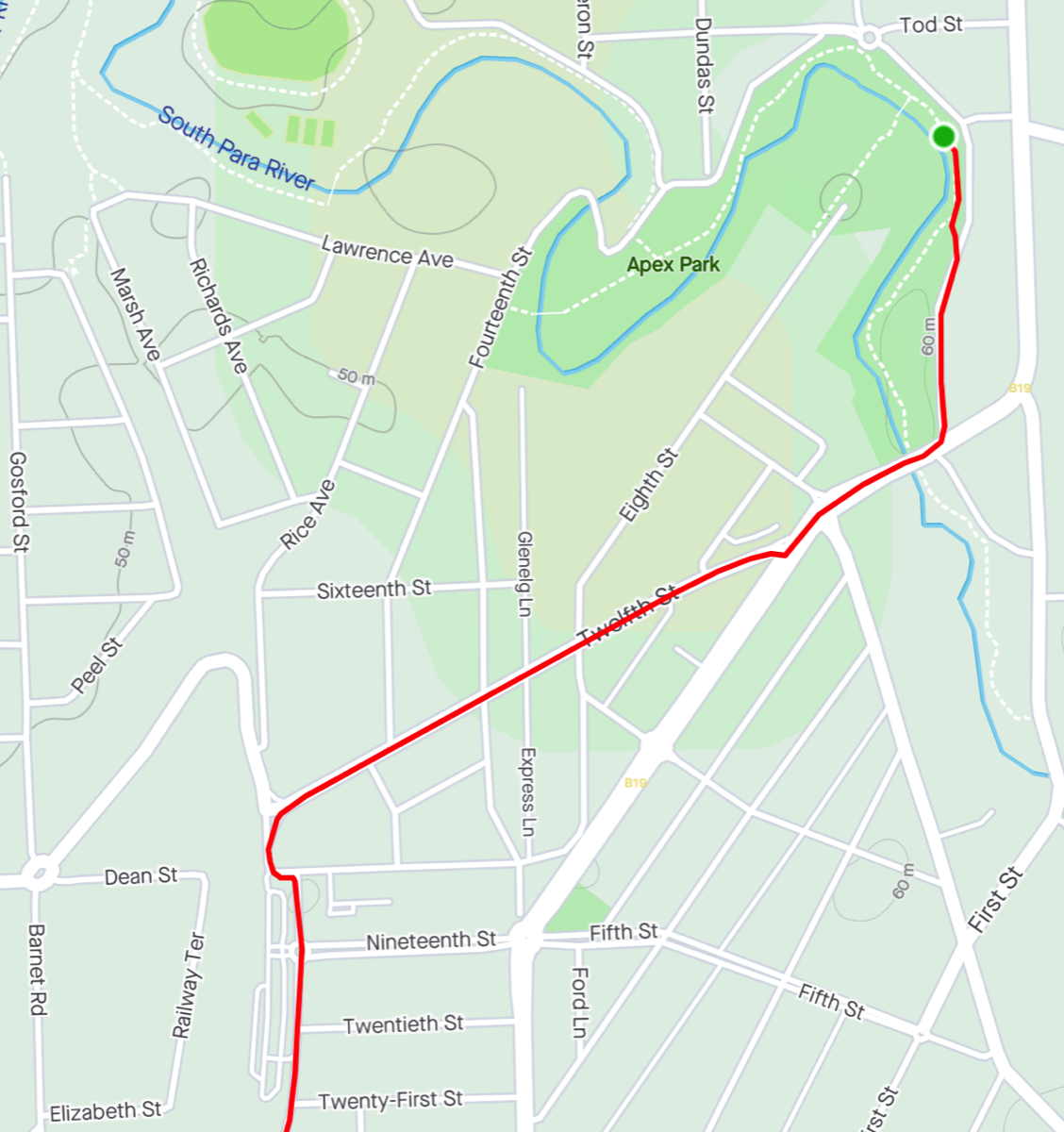
Starting at where my routes to Gawler ended there are a couple of ways to get to Gawler railway station.
You can backtrack and ride up Fourteenth Street or you can ride down Julian Terrace and onto Murray Street before making a right hand turn onto Twelfth Street. The latter has quite a bit of traffic and the right turn into Twelfth Street can be "interesting".
Note there are pedestrian bridges across the river near the starting point and in Apex Park but they are very narrow. I'd rather play on the road than try to use them (and I have used the one in Apex Park once).
If I wasn't heading for the railway station itself I would do the dogleg over the Overway Bridge rather than go past the railway station.
Riding past at 1.3km.
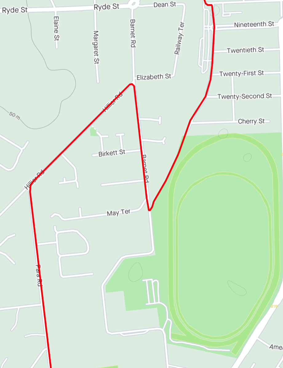
Gawler Oval
I'm not even sure if this will open when the railway line reopens. The path beside it is overgrown with weeds and it's exit to Barnet Road is narrow and gravel.
Turning left is possible but it will take you to Main North Road and then you would need to right turn into Para Road so it is easier to backtrack to Hillier Road.
Riding past at 2km.
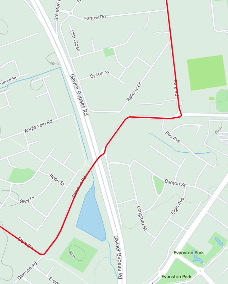
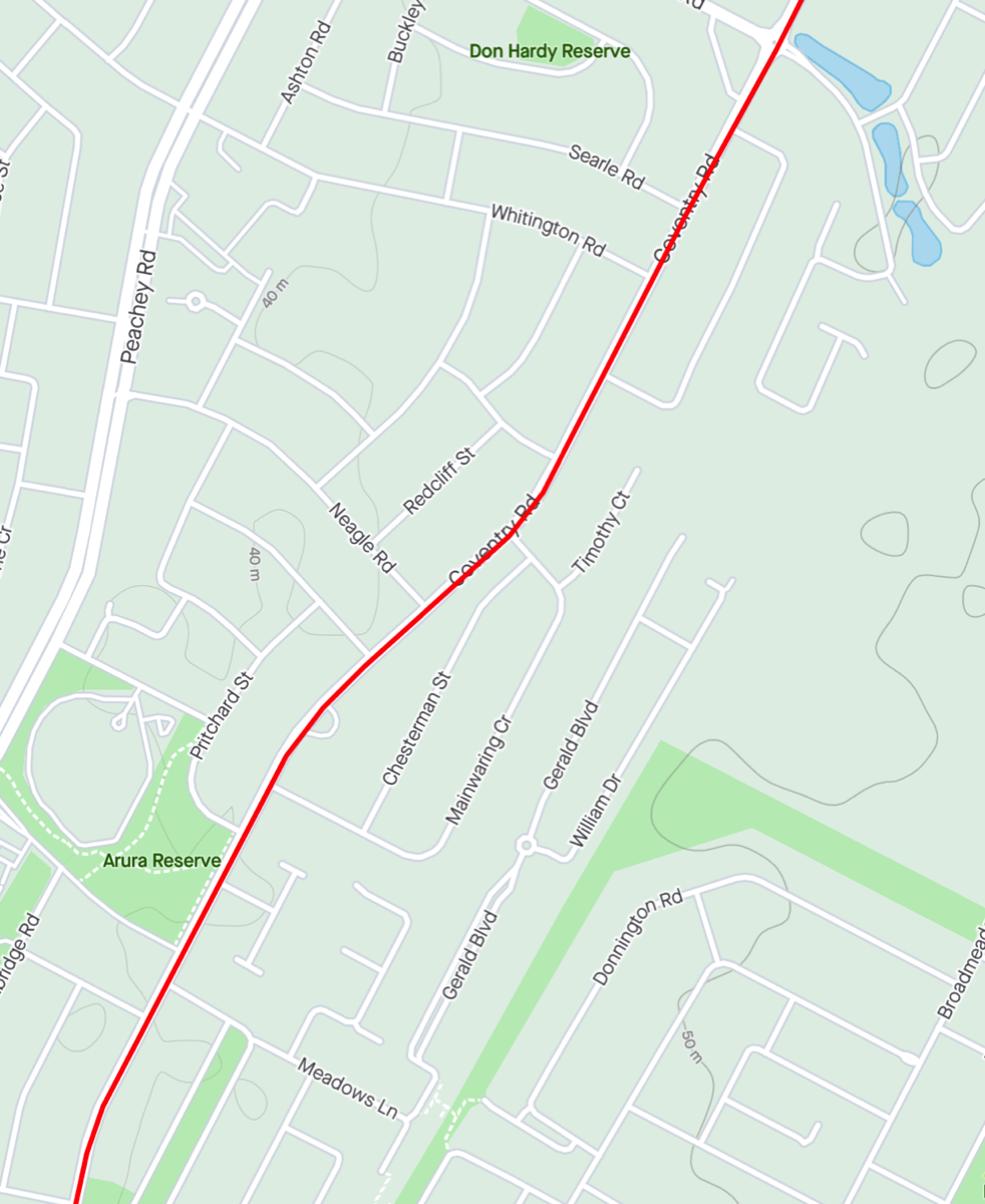
Tambelin
Evanston railway station is down Railway Crescent but you need to backtrack from it in order to go south from there so I ignored it on my ride by.
Tambelin is on the corner of Dawson and Clark Roads.
Riding past Railway Crescent at 3.6km and Tambelin at 5.1km.
Water fountain
Rather than ride all the way up Clark Road to Coventry Road turn left into the Oleana estate at Andreas Avenue. At Orleana Blvd turn left and then right around the roundabout. The water fountain is tucked away near the swings in the park.

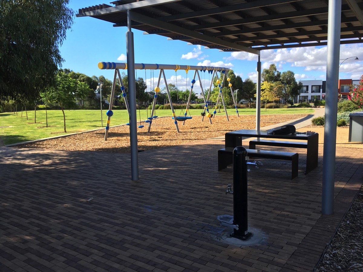
A non standard hidden water fountain
Coventry Road
Kudla is the only station near the stretch of Coventry Road between Clark Road and Dalkeith Road. Access could be via Piggott Road or Dalkeith Road.
Piggott Road is at around 8.6km.
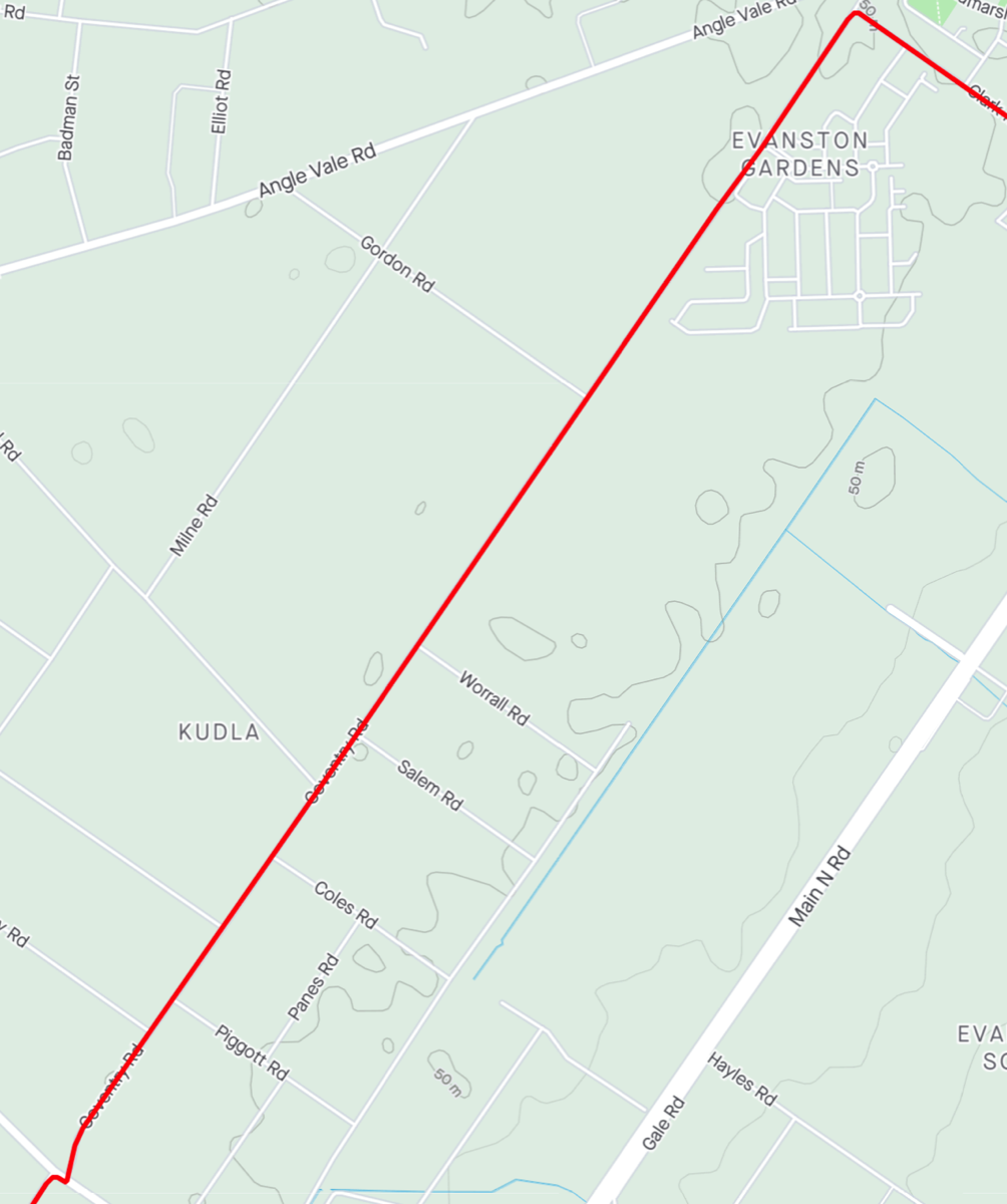
Munno Para
Munno Para station is down Newton Blvd after 11.3km. Munno Para has lifts to get to the Adelaide bound platform.
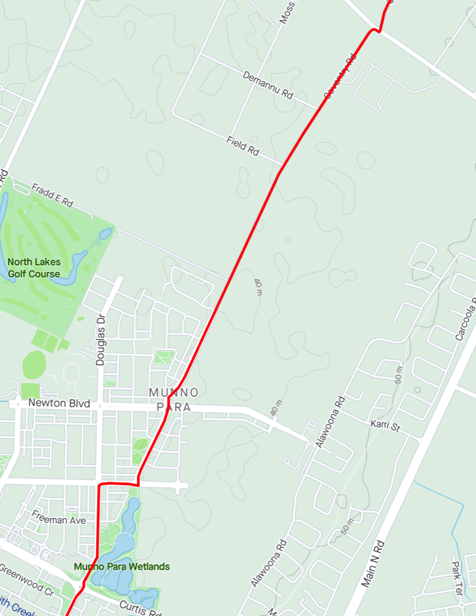
Smithfield
Smithfield station is down Anderson Walk. It is a major station and all trains should stop there. There is a shared path that follows Smith Creek Drain that takes you to the station, although it's on the southern side of Anderson Walk.
You pass Anderson Talk after 12.9km.
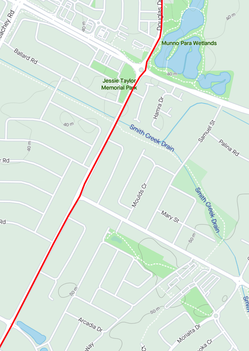
Broadmeadows
Broadmeadows is accessible down Bishopstone Road and Meadows Lane after 14.9km.
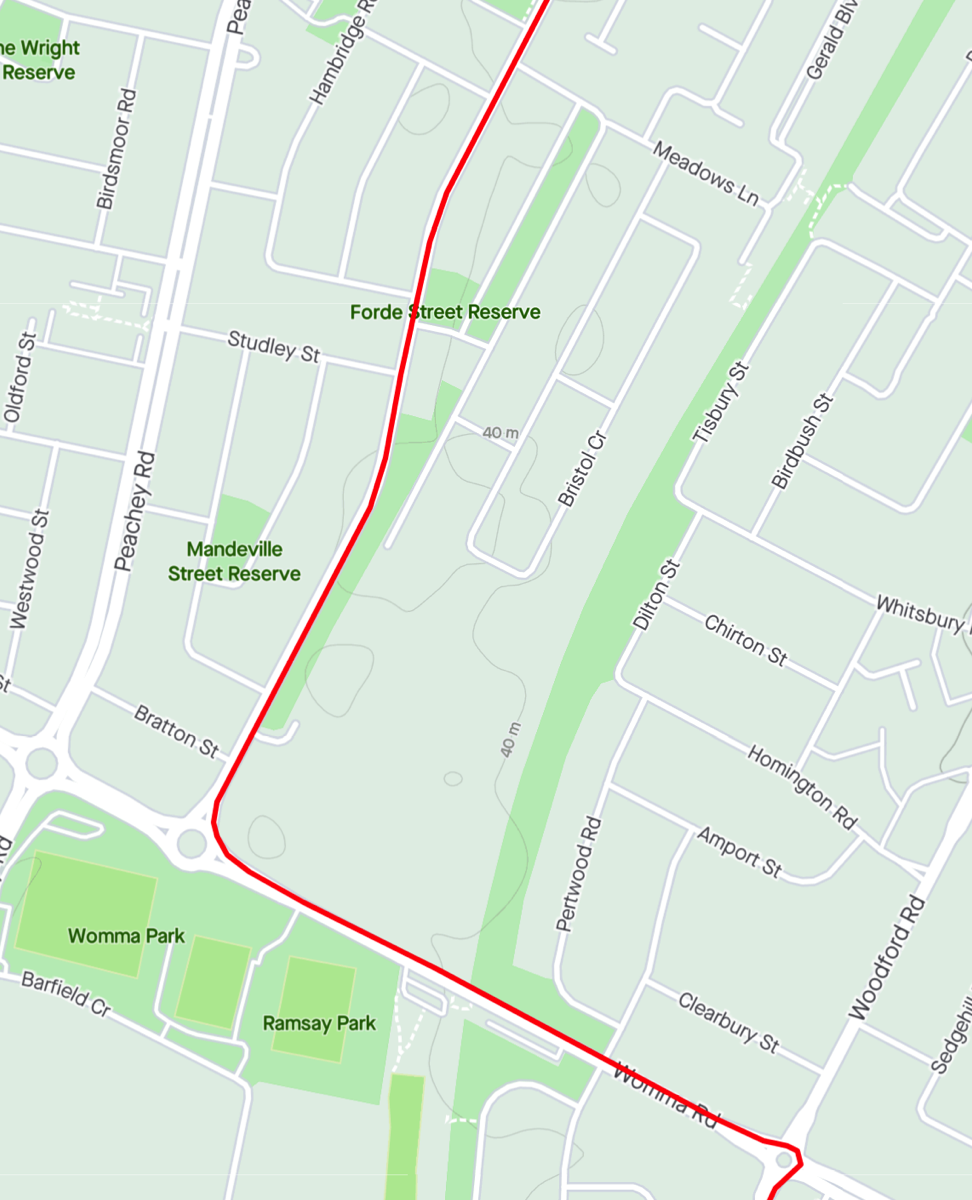
Womma
Coventry Road becomes Heytesbury Road. At the end is a roundabout and you should turn left onto Womma Road and the railway station is further down on the right and you pass it after 16.3km. Continue to the next roundabout and turn right down Woodford Road.
It is also possible to turn right at the Heytesbury/Womma Road roundabout and then left onto Peachey Road. Peachey Road has more traffic and crosses the railway line via a bridge rather than a railway crossing.
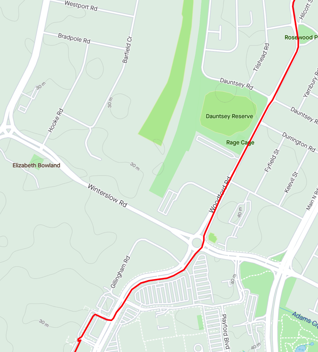
Elizabeth
Another major station where all trains should stop. It's also a bus interchange so there could be a lot of buses entering and exiting. The first intersection after McDonalds has traffic lights and while I used it to turn right you will pass the bus stops and so there might be a number of buses manoeuvring into and out of their stops. The next intersection doesn't have lights.
Access to the small segment of Gawler Greenway is tricky since there is not a ramp directly in front of it. You need to go into the carpark use the ramp there and circle pack.
Heading south on Goodman Road is perhaps a better idea as the Greenway is a bit Mickey Mouse, it is built with paving and has a lot of rubbish, natural and manmade, on it.
Elizabeth station is at 18.4km.
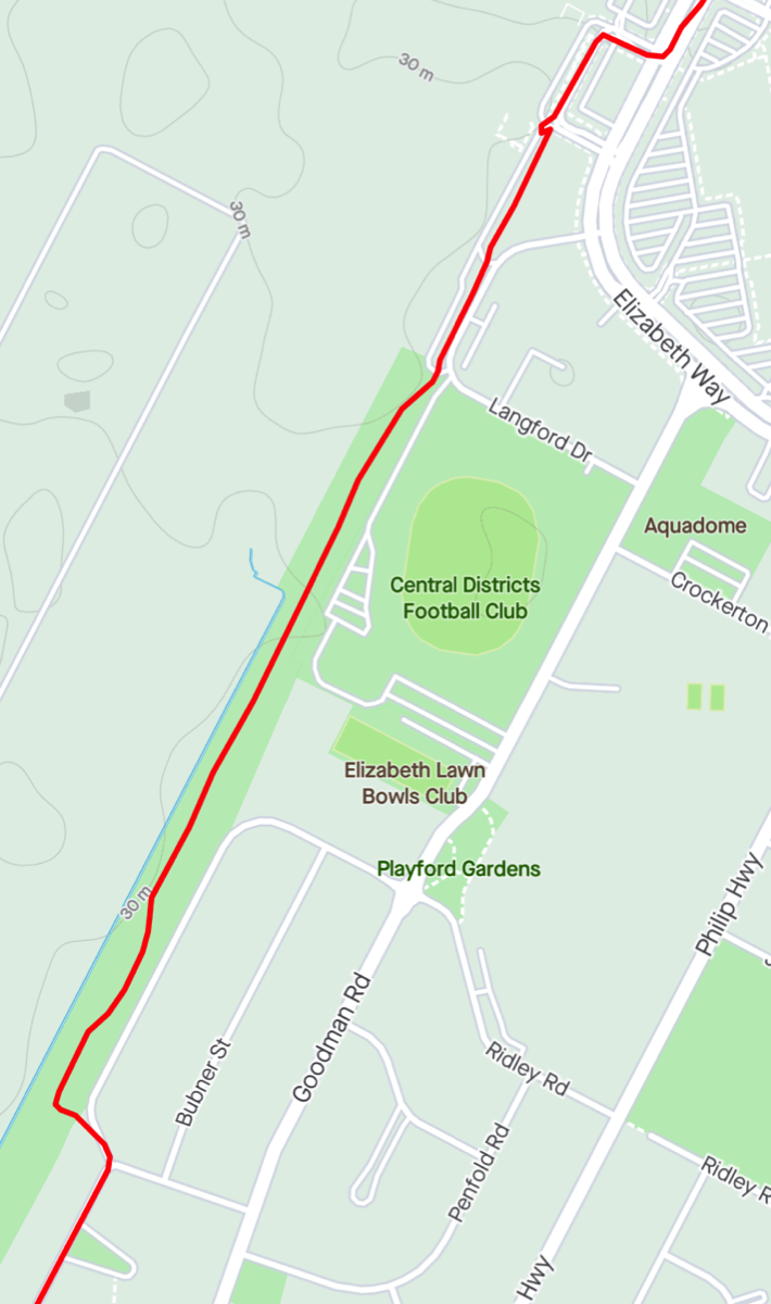
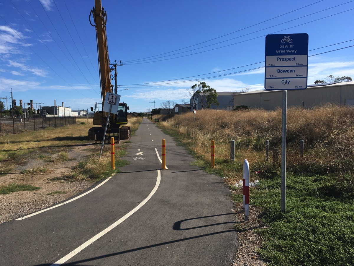
Gawler Greenway
Just a small segment, it doesn't even reach Elizabeth South station. It's not tarmac but paving but it does have dedicated lighting. It currently ends with a narrow pedestrian path to the street. Clearly just a temporary measure but it's unclear when work will continue towards Elizabeth South station.
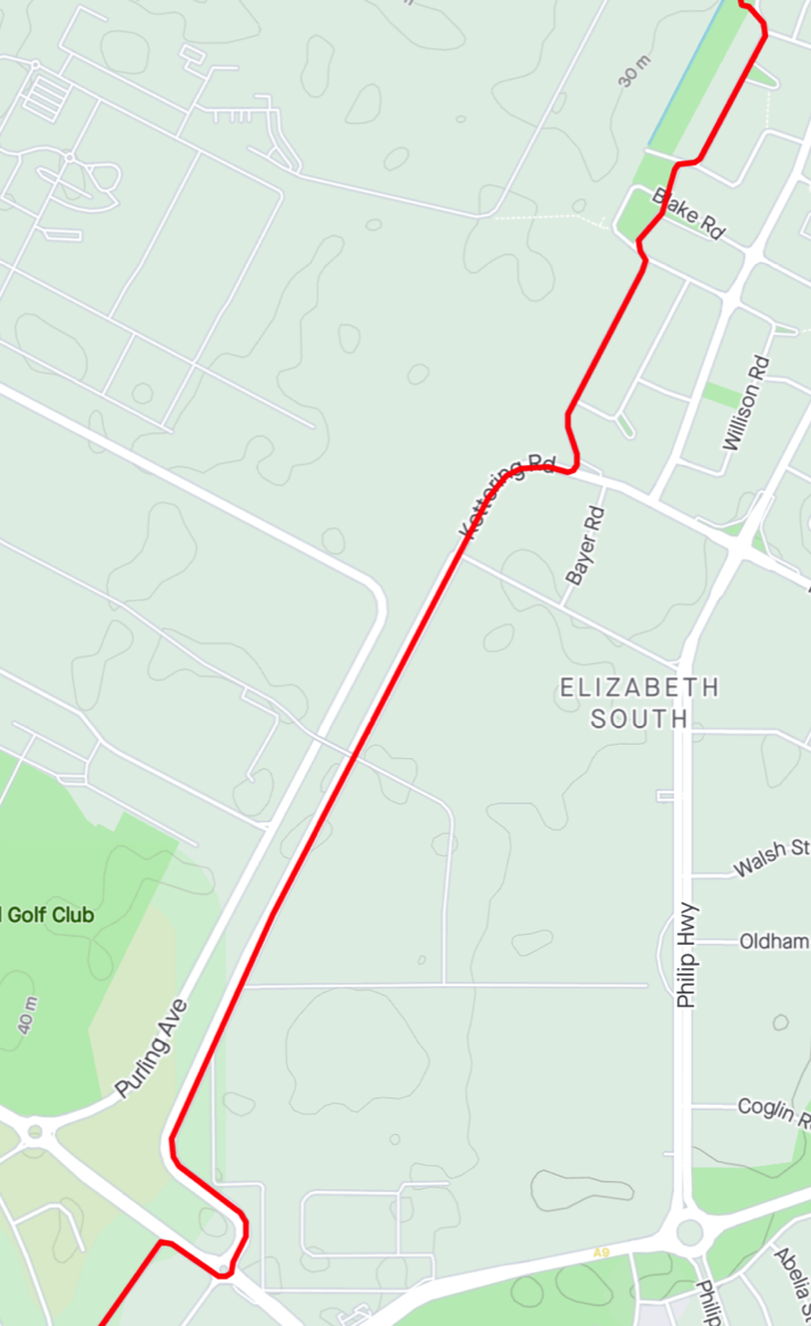
Elizabeth South & Nurlutta
Elizabeth South station is accessed via Blake Road.
Nurlutta station is on Commercial Road between Purling Avenue and Kettering Road.
It would have been good if you could go straight across the roundabout at Kettering/Commercial and go down Fisher Street but it isn't a through road so you need to turn right and then left down Middle Row instead.
Elizabeth South is at approximately 20.2km and Nurlutta is at 23.1km.
Salisbury
Middle Row curves around into Loades Street and at the end you leave the road and enter a shared path down to Festival Court and then down Festival Court to another path. At a junction turn right rather than going under Salisbury Highway and then follow it under the railway line, Turn left and continue along the path before going across a pedestrian bridge that crosses Salisbury Highway and follow Paternoster Row to Park Terrace. The railway station is to the left. All trains should stop at Salisbury. Salisbury is at around 24.8km.
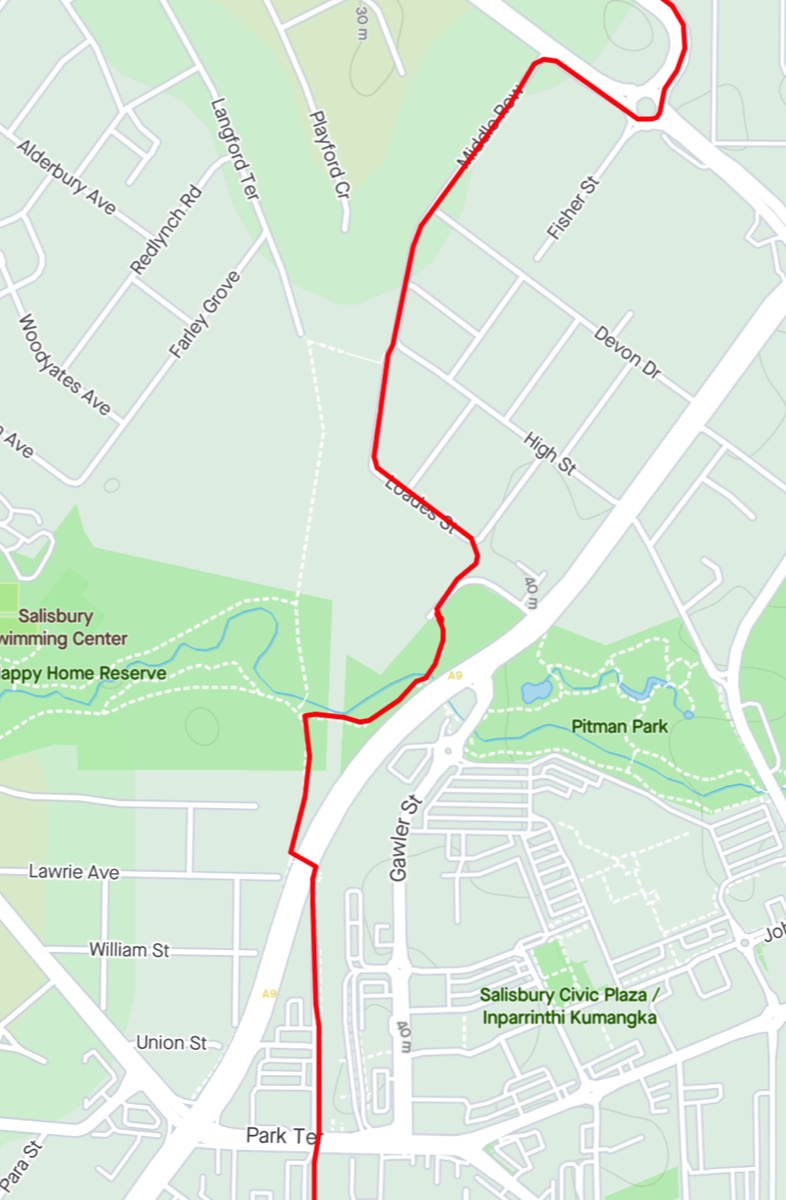
Access from Loades Street down to Festival Court
Path from Festival Court
Chidda
Continue across Park Terrace and down the shared path to York Terrace. Chidda station is opposite the cemetery. Passing Chidda after about 26.1km.
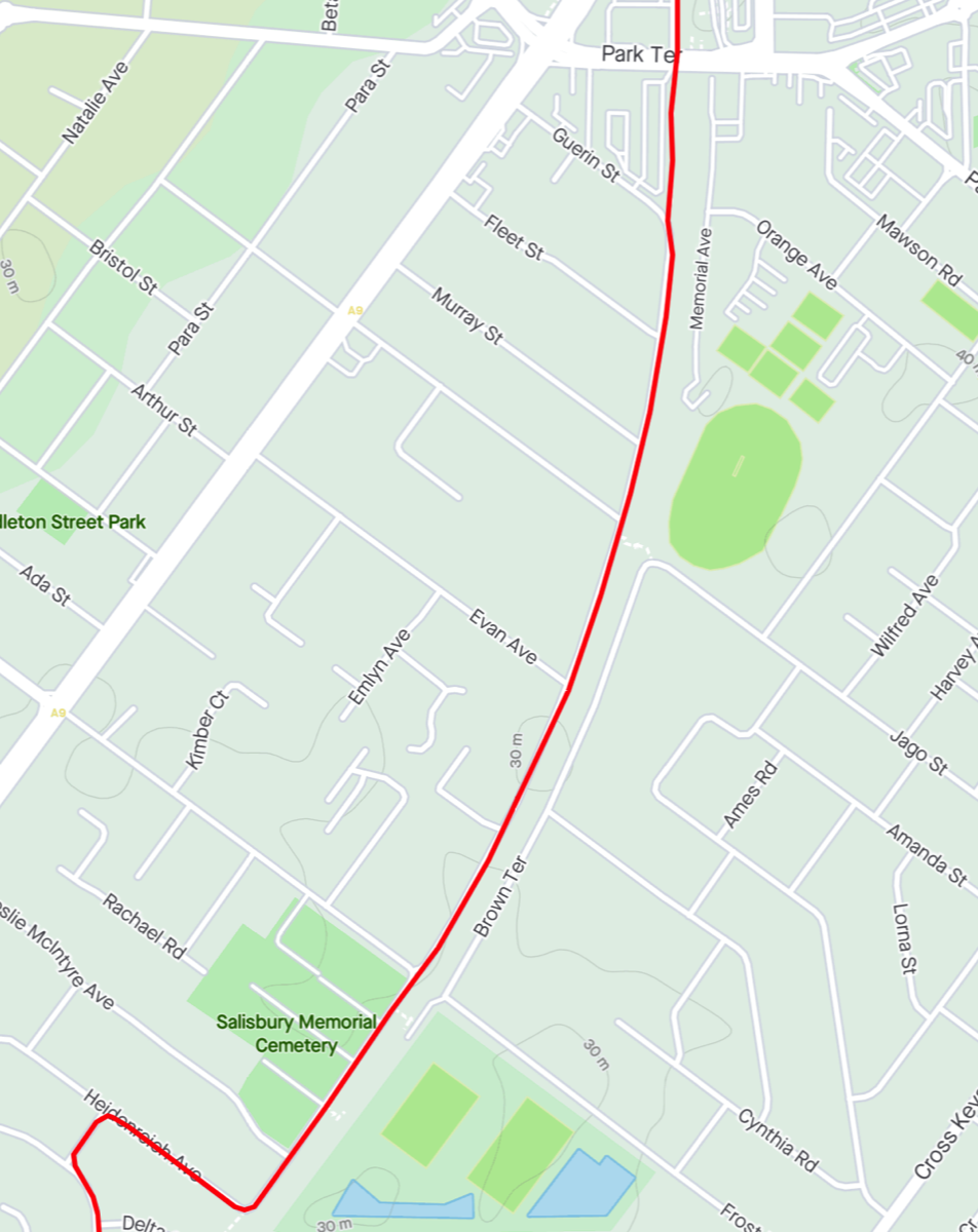
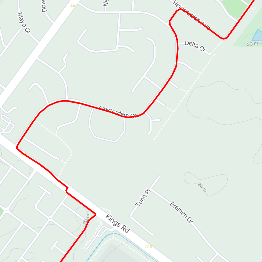
Parafield
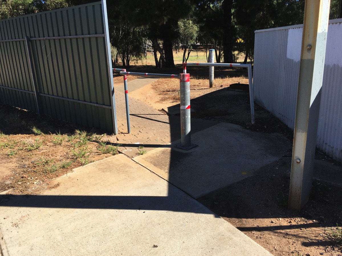
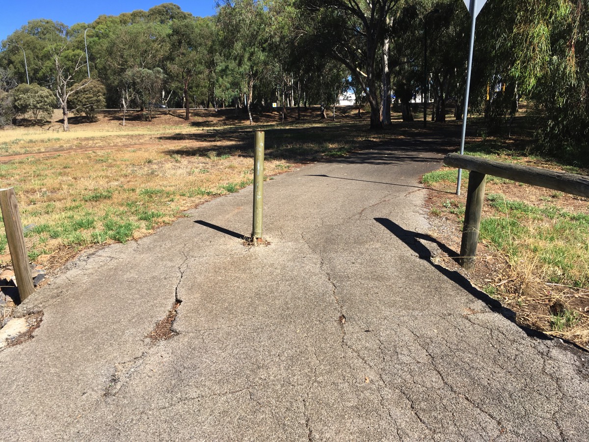
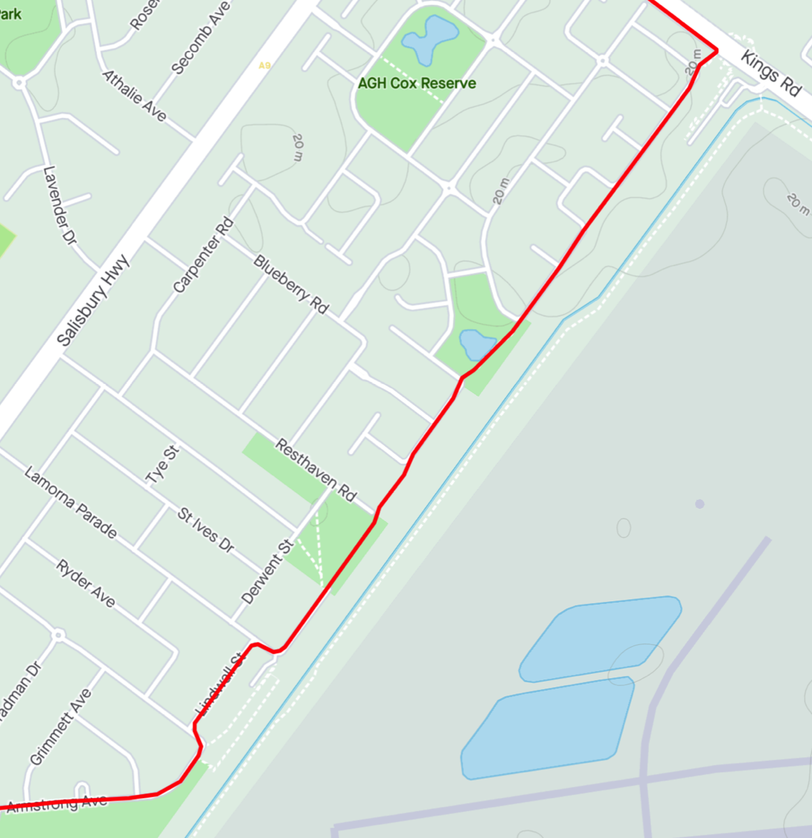
CycleInstead (and this map) suggests that there is a path next to the railway line. The first part to Delta Ct exists but the rest would be generously called a dirt track. It's not really worth trying. It would be different if it extended all the way to Kings Road but Thomas More College is in the way so avoid it and keep to the road. There is a more well defined dirt track on the other side of the school, accessed via Venlo Ct, but I've chosen to show the route on the road. There is a traffic light controlled pedestrian crossing which makes crossing Kings Road easier, and then you can ride down the footpath to the railway station.
From Parafield it is possible to ride on either side of the railway line. If you cross to the Parafield airport side it is an uninterrupted, relatively straight run to Mawson Lakes, although negotiating the Parafield station car park could be improved. On the western side it is a series of side streets (some with sharrows) and connecting shared paths. It's not clear if Salisbury council intends this to be part of the Gawler Greenway but the work is newer than the eastern side.
Passing Parafield after 28km, all trains should stop at Parafield.
Parafield Gardens
I chose to keep on the road and ride around the park in front of Parafield Gardens station but you can short cut it by riding through the car park.
Shortly after the station is Parafield Gardens oval. Currently there is no path through it so keep to the road and go around it.
Parafield Gardens is at about the 29.2km mark.
Greenfields
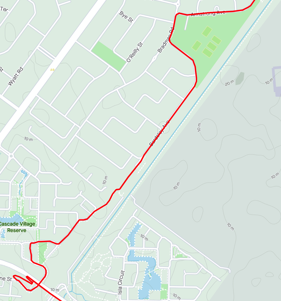
Turn down Barnsley Avenue and follow it to the end where you will find Greenfields station. You need to go up the ramp from the street and cycle along in front of the station. At the southern end of the station you can access the station and then cycle along a path on the other side. There is an old narrow bridge that crosses the drain and takes you to the path that runs from Parafield station alongside Parafield airport. Greenfields is at about 30.6km.
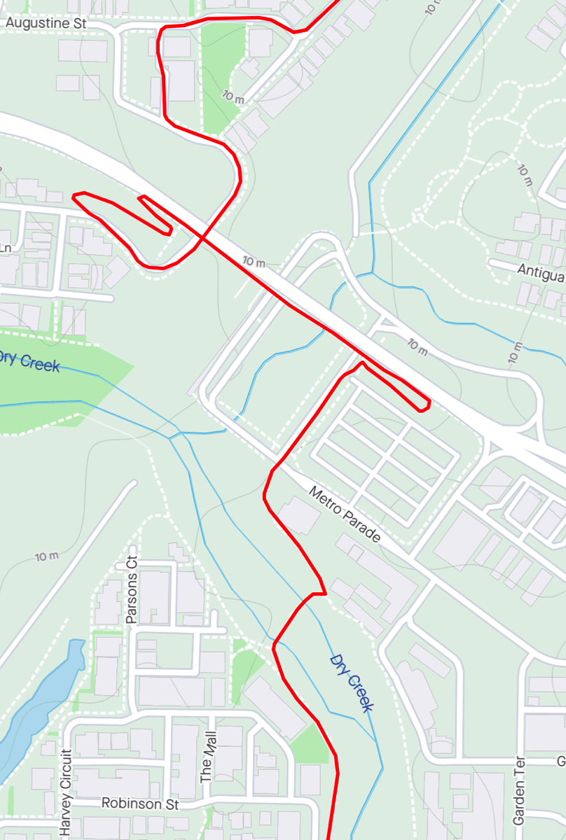
I dogleg to the right and follow a path into Mawson Lakes. Use one of the ramps and turn left into Adeline Street and then turn left into Franklin Avenue. Follow Franklin Avenue around the bend and turn left into the first lane and then turn left onto Augustine Street. This will take you under the Elder Smith Drive bridge.
If you want to continue to Mawson Lakes Interchange use the ramp to ascend to the bridge and turn right and cross the bridge. On the other side is another ramp that will take you down to the station.
You can also abandon following that railway line and rather than go up the ramp turn left into Ridley Street. Before it turns to the right go up a ramp and cross the shared path bridge. On the other side turn right and follow the path. It will go under Elder Drive and when you come to the find T junction at the end turn right and cross the causeway and then turn left. This is the Dry Creek Tail and will take you to the Tapa Martinthi Yala.
Mawson Lakes Interchange
Another major station where all trains should stop. This is probably the last station you should consider using if you are going to abandon riding and ride the train to Adelaide. The carpark for Mawson Lakes Interchange is at around 32.2km
If you're continuing this ride then you're going to cut through Mawson Lakes, initially on the Dry Creek Trail. Rather than follow the road around to the station proper continue straight onto the shared path. There will be a bridge across the creek on your right, you can either take it or continue.
Mawson Lakes
If you took the bridge then go straight across The Strand and keep to the right as the path splits. If you went straight on then when you reach the Strand then turn right and cross the floodway and turn left onto the other path. Be aware that ramps in Mawson Lakes are evil things.
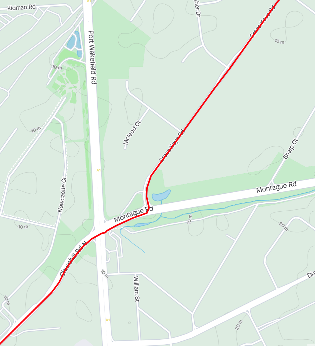
The path branch and you should take the left side, this will take you under Mawson Lakes Boulevard. Shortly after a path from the left merges with this path there will be a paved path to your right which you should take. Keep on this paved path, it is mostly straight but it does cross a road and skirt around bends. You will cross Mawson Lakes Boulevard again, watch for cars speeding around the bend, and cross a park next to a lake and go around a shelter and exit to Shearwater Drive. Turn to the right and go down Egret Street. Directly in front of you is a path that crosses a drain and takes you onto Cross Keys Road. Continue straight down Cross Keys Road.
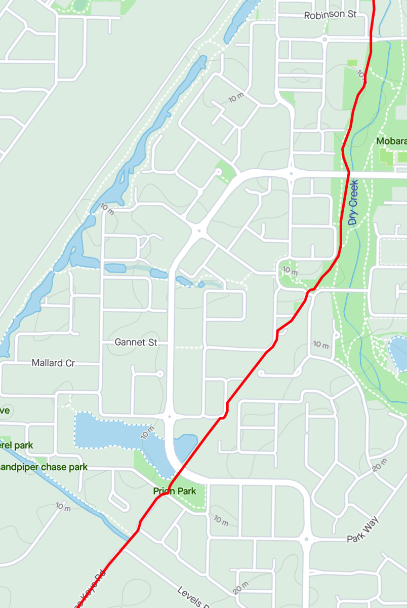
Montague Road
You need to turn right from Cross Keys Road onto Montague Road. The intersection with Port Wakefield is interesting. You want to go straight across to Churchill Road North but there are two left turning lanes. If you are comfortable and there is traffic to trigger the lights you can stay out in one of the straight across lanes or there is a small alcove next to the traffic light with a cyclist signal button. The left turn has it's own cycle so you can easily cross from there once you get a green light (or straight across gets one).
Churchill Road North has a lot of heavy vehicles but is quite wide once the median strip ends.
Dry Creek
Turn into High Street, this will take you to the final train station. You've travelled 36.6km once you've reached High Street.
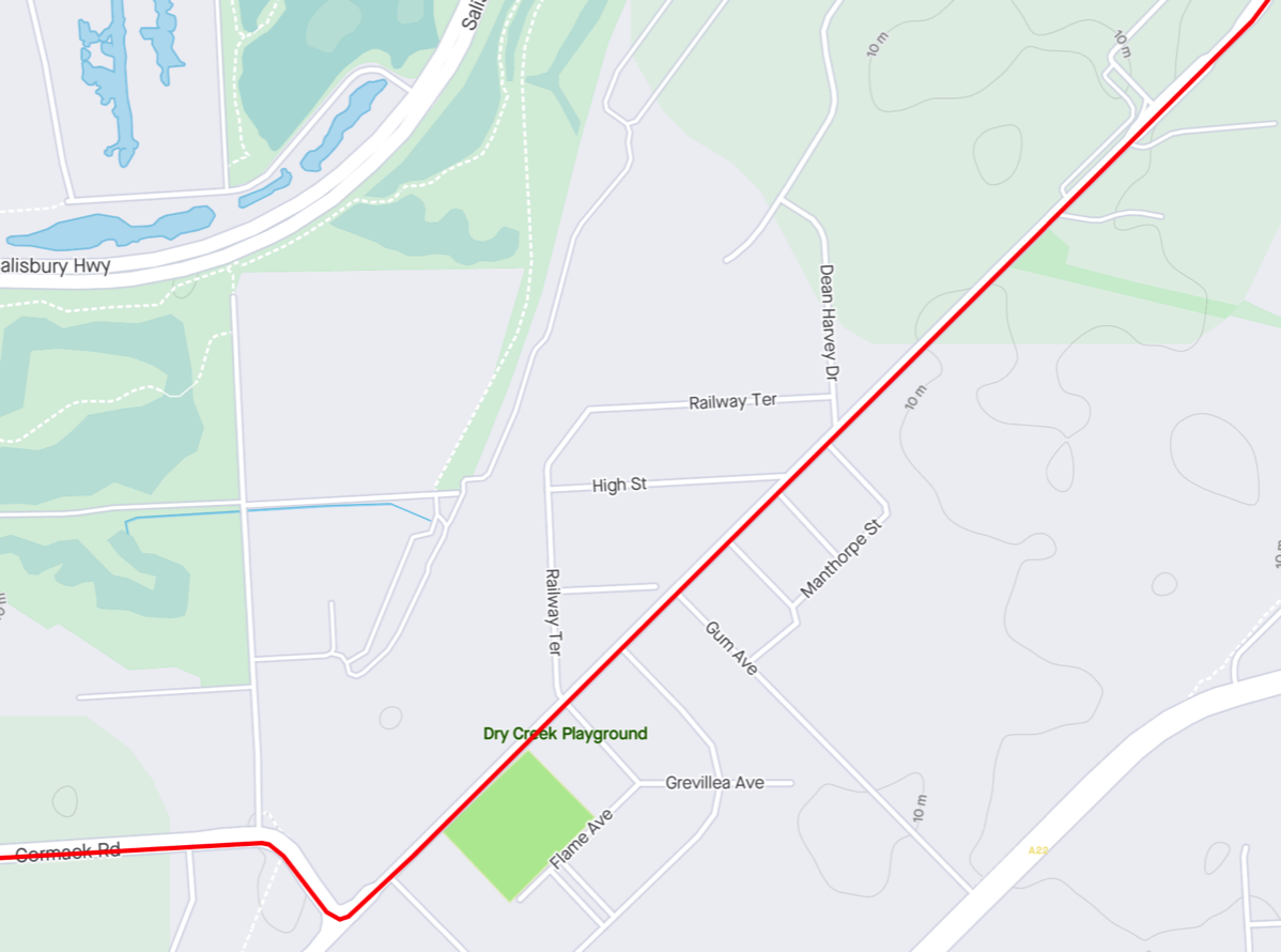
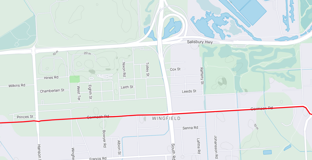
If you are still riding then continue down Chruchill Road North and turn right into Cormack Road. From here you'll head west to Port Adelaide.
After crossing the railway lines (both Gawler passenger and northern freight) you will pass the Gawler Greenway. Turning into it to the left will take you to the city and turning right will take you onto Magazine Road. Going all the way to the end will take you to a path that will lead you back to Salt Pan Junction or if you take Henschke Street it will take you to a disappointingly short section of the Gawler Greenway that will eventually dump you onto Port Wakefield Road and the intersection with Salisbury Highway.
Gawler Greenway heading towards Adelaide
Gawler Greenway heading towards "Gawler"
This traffic island is sort of useful if you are heading to Magazine Road but maybe just do a right turn into the road rather than use this curious construction.
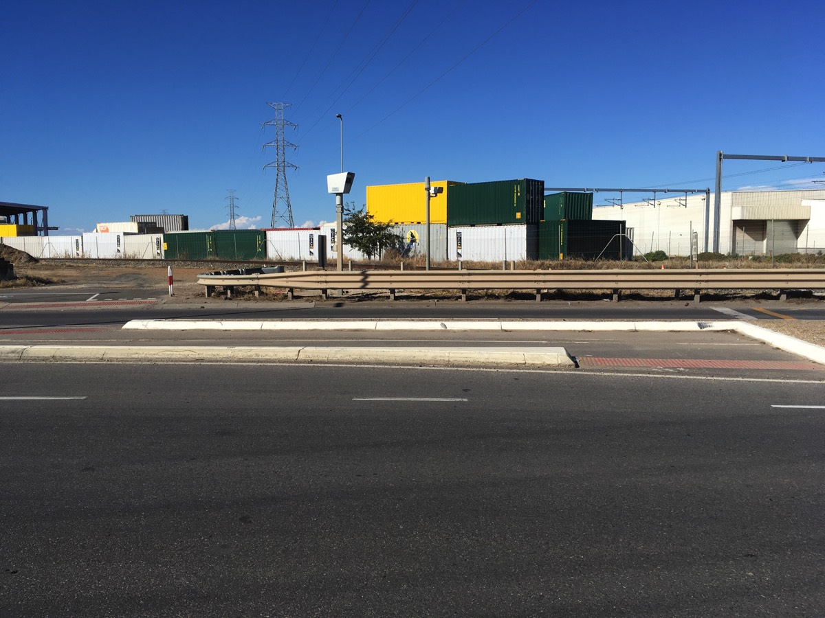
Cormack Road
Cormack Road is wide, boring and potentially full of heavy vehicles.
At South Road you could potentially turn right and follow a bike lane up to a shared path that will lead you to the same culvert crossing that Magazine Road takes you to.
If you continue on Cormack to Hanson Road you could turn right onto Hanson Road and cross the bridge and get to the Port River Bikeway directly.
Or just keep on Cormack Road.
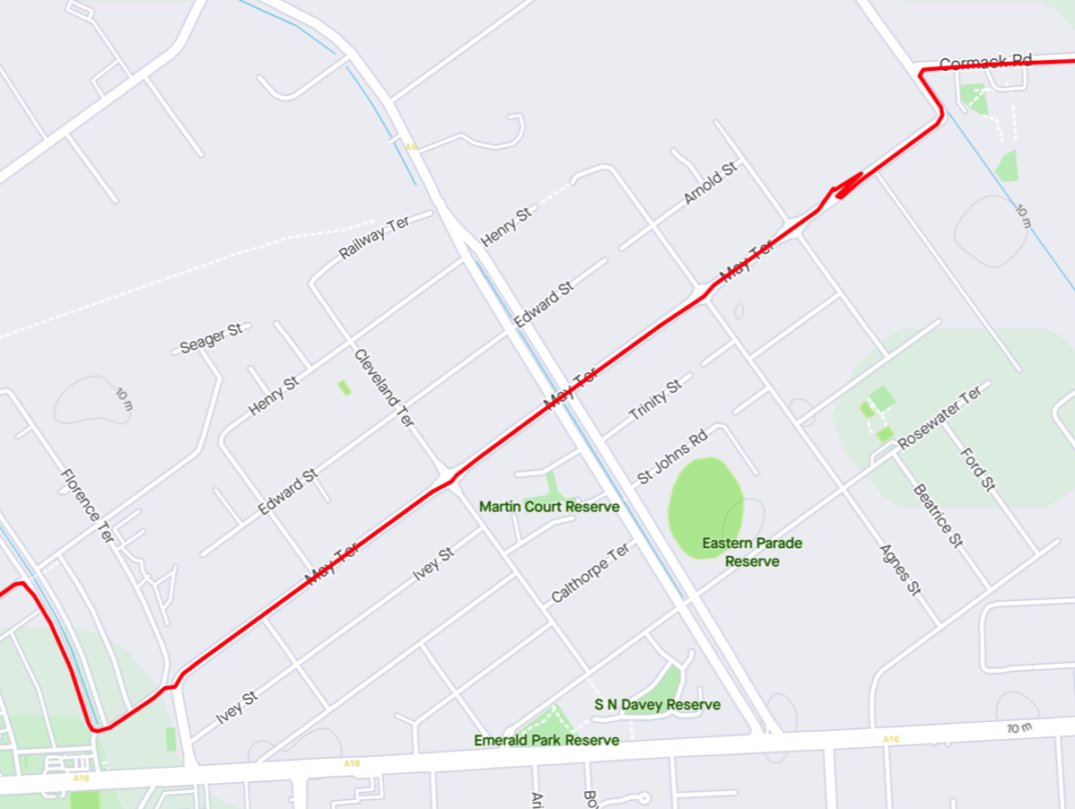
May Terrace
At the end of Cormack Road turn left and then follow May Terrace (you don't need to stop at the Buddhist temple).
As you cross Eastern Parade you could turn right and follow it to the Port Expressway and then turn left for the Port River Bikeway.
But following May Terrace as it takes a bend to the left there is a pedestrian crossing over the disused railway line. Continue left onto Florence Terrace and then turn right onto Jenkins Street.
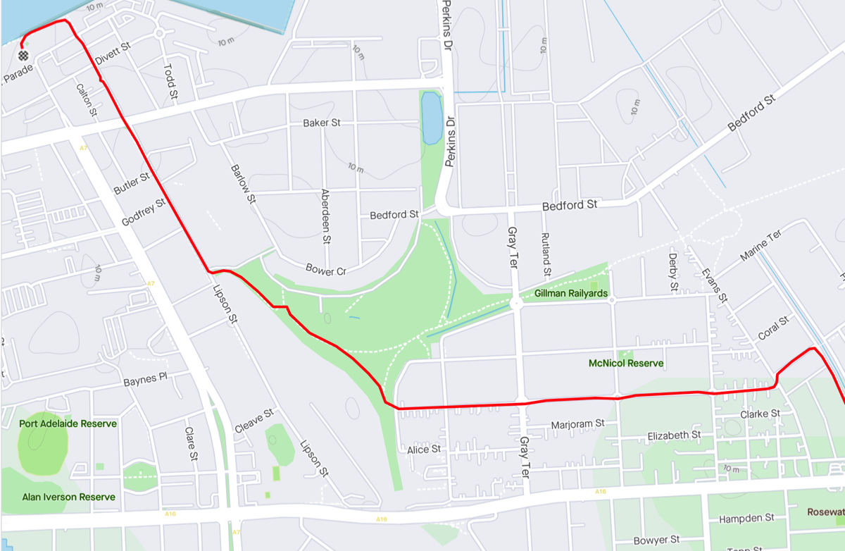
Into Port Adelaide
From Jenkins Street turn left into Neptune Terrace and at Evans Street turn left and then right into Margaret Terrace. This becomes Rosetta Street and takes you directly to the Outer Harbor Greenway. Follow it along Lipson Street before turning left at the wharf and stopping at the lighthouse! You've travelled about 46km from Gawler to Port Adelaide on this route.